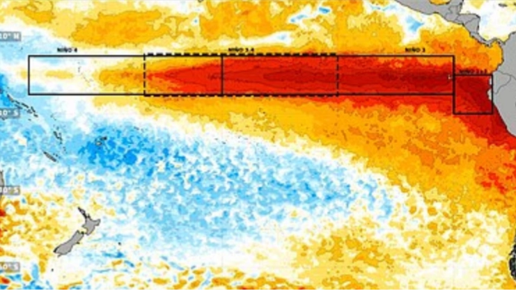
A huge area of unusually warm water appears to be spreading across the Pacific Ocean, raising fears that this year’s Super El Niño could become the strongest in 1,000 years.
El Niño refers to the unusually warm phase that occurs when surface waters in the Pacific Ocean heat up.
It happens when normal, east-to-west trade winds weaken or reverse, causing warm water to pool along the Americas and disrupt global weather, often causing heavy rains in some regions and severe droughts in others.
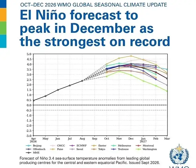
While there have been only a handful of these cases since 1950, the World Meteorological Organization said this El Niño is likely to strengthen over the rest of 2026, driving more extreme weather around much of the globe.
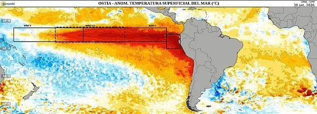
Now, images released by Peru’s national weather service show how quickly the warm water has spread in just two weeks.
(Senhami)
From 30 September, a map showed a large area of warm water near the coasts of Ecuador and Peru.
However, a new image from 14 October suggests that the heat is spreading further south towards Chile, meaning some parts of the ocean are now more than 3°C warmer than normal.
“I think that this year’s El Niño event is likely to be the strongest in 1,000 years if the latest models of its peak prove accurate,” writes climate scientist Zeke Hausfather for The Climate Brink.
For Brits wondering why it’s been unusually warm this month, Stephen Dixon, Met Office Spokesman, says it’s not all down to the El Niño.
(WMO)
“October has started warmer than average for the time of year, but not in a historically significant way,” Dixon tells LADbible.
“We’ve reached into the low 20s Celsius today while the average daily maximum temperature for this month is 13.1C.
“That being said, the natural variability of the UK climate means that we can indeed see temperatures into the 20s, even in October.”
He added: “The temperatures at the moment are largely down to a milder air mass over southern parts of the UK, helping to keep temperatures above average for the time of year.
(ECMWF)
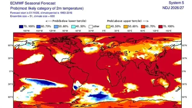
“El Nino is one of a number of large-scale atmospheric drivers that influence weather patterns in the UK and Europe.
“However, other atmospheric and oceanic factors will continue to play an important role in determining conditions over the coming months. It could lead to more wet and stormier conditions later in autumn and early winter, while it could also bring drier, cooler and more settled conditions later in the winter.
“However, no single weather event in the UK can be attributed to El Nino alone and much will depend on its interaction with other climate drivers.”
Leave a Reply